2 photos
@quadrant-C11-eastern-visayas
Seems you enter wrong password click here to enter password again.
Nothing has been posted here yet - be the first!
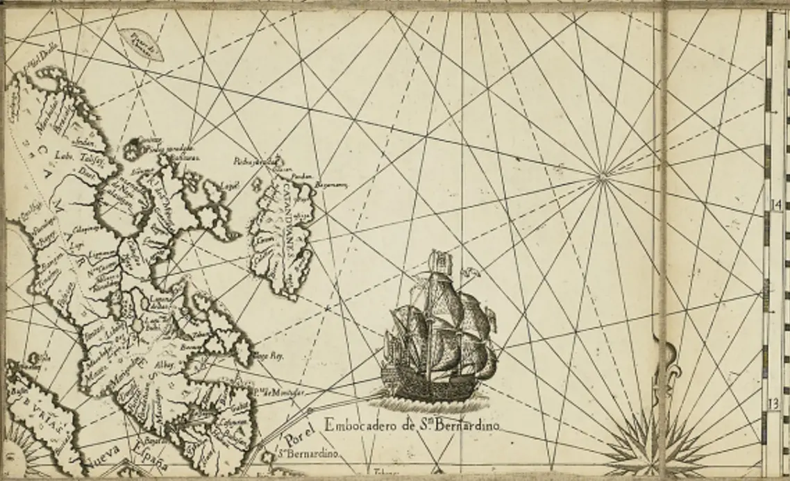
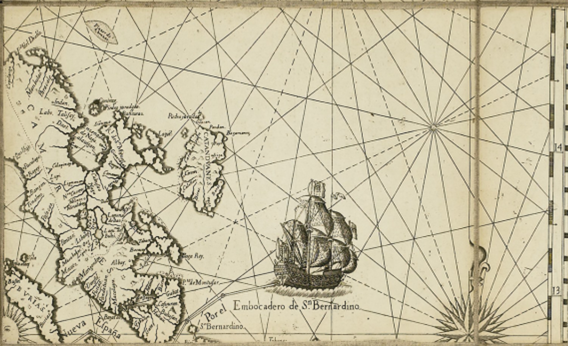
This quadrant features the San Bernardino Strait, which serves as a crucial maritime passage between Luzon and the Visayas.
Prominent islands include Samar, Leyte, Masbate, and Ticao, with detailed coastlines and settlements marked.
The Bicol Peninsula and the northern coast of Leyte are also visible, showcasing the regional connection between Luzon and the Visayas.
A large Spanish galleon is depicted in the San Bernardino Strait, symbolizing its role in the Manila-Acapulco Galleon Trade as an entry and exit route for Spanish vessels.
Rhumb lines and compass roses are present, indicating Spanish navigational routes and the importance of the strait for maritime travel.
The Visayan waters were key transit points for trade between Manila, Mexico, and the rest of Asia.
Several settlements and towns in Samar, Leyte, and Masbate are labeled, reflecting the extent of Spanish control and missionary activities.
Catholic missions and indigenous settlements are indicated, showing the religious and administrative reach of the Spanish.
Naval patrol routes suggest efforts to secure these waters from pirates and other threats.
The San Bernardino Strait was a critical chokepoint for Spanish defense, as it provided a direct route from the Pacific Ocean to Manila.
Fortifications and garrisons may have existed along key coastal areas to protect against Moro raiders and foreign incursions.
The islands of Masbate and Ticao were used as stopovers for ships navigating the archipelago.
The map acknowledges native communities, with settlements named in Spanish and indigenous languages.
Trade routes between the Visayas and Luzon are apparent, indicating active commerce and interaction.
The influence of the Austronesian seafarers in these waters suggests the continuation of pre-colonial trade networks under Spanish rule.
Highlights San Bernardino Strait as a vital maritime passage in the Philippines.
Demonstrates Spanish colonial administration and missionary efforts in Eastern Visayas.
Showcases the importance of Visayan islands in trade, travel, and security.
Provides insights into indigenous settlements and their integration into the Spanish colonial system.
Eastern Visayas
