Quadrant C11 Eastern Visayas

Quadrant C11 Eastern Visayas

@quadrant-C11-eastern-visayas

Associated Sub Page

Murillo Velarde 1734 Map

Recently Viewed Pages

  • 0 Likes 0 Comments 19.5K Views 0 Favourites
  • 2 Likes 0 Comments 12.9K Views 1 Favourite
  • 0 Likes 0 Comments 1.8K Views 0 Favourites

Overview

Key Insights from Quadrant C11 – Eastern Visayas (Murillo Velarde 1734 Map)

1. Geographic Representation

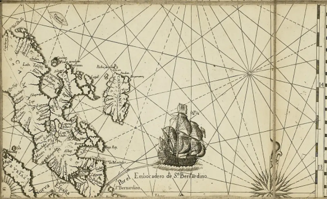
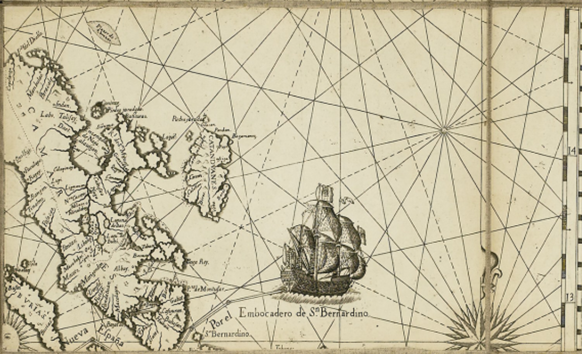
  • This quadrant features the San Bernardino Strait, which serves as a crucial maritime passage between Luzon and the Visayas.

  • Prominent islands include Samar, Leyte, Masbate, and Ticao, with detailed coastlines and settlements marked.

  • The Bicol Peninsula and the northern coast of Leyte are also visible, showcasing the regional connection between Luzon and the Visayas.

2. Maritime and Trade Significance

  • A large Spanish galleon is depicted in the San Bernardino Strait, symbolizing its role in the Manila-Acapulco Galleon Trade as an entry and exit route for Spanish vessels.

  • Rhumb lines and compass roses are present, indicating Spanish navigational routes and the importance of the strait for maritime travel.

  • The Visayan waters were key transit points for trade between Manila, Mexico, and the rest of Asia.

3. Spanish Colonial Influence

  • Several settlements and towns in Samar, Leyte, and Masbate are labeled, reflecting the extent of Spanish control and missionary activities.

  • Catholic missions and indigenous settlements are indicated, showing the religious and administrative reach of the Spanish.

  • Naval patrol routes suggest efforts to secure these waters from pirates and other threats.

4. Strategic and Military Importance

  • The San Bernardino Strait was a critical chokepoint for Spanish defense, as it provided a direct route from the Pacific Ocean to Manila.

  • Fortifications and garrisons may have existed along key coastal areas to protect against Moro raiders and foreign incursions.

  • The islands of Masbate and Ticao were used as stopovers for ships navigating the archipelago.

5. Cultural and Indigenous Presence

  • The map acknowledges native communities, with settlements named in Spanish and indigenous languages.

  • Trade routes between the Visayas and Luzon are apparent, indicating active commerce and interaction.

  • The influence of the Austronesian seafarers in these waters suggests the continuation of pre-colonial trade networks under Spanish rule.

Significance of This Quadrant

  • Highlights San Bernardino Strait as a vital maritime passage in the Philippines.

  • Demonstrates Spanish colonial administration and missionary efforts in Eastern Visayas.

  • Showcases the importance of Visayan islands in trade, travel, and security.

  • Provides insights into indigenous settlements and their integration into the Spanish colonial system.
