Overview
Quadrant B22 – Western Mindanao on the Murillo Velarde 1734 Map
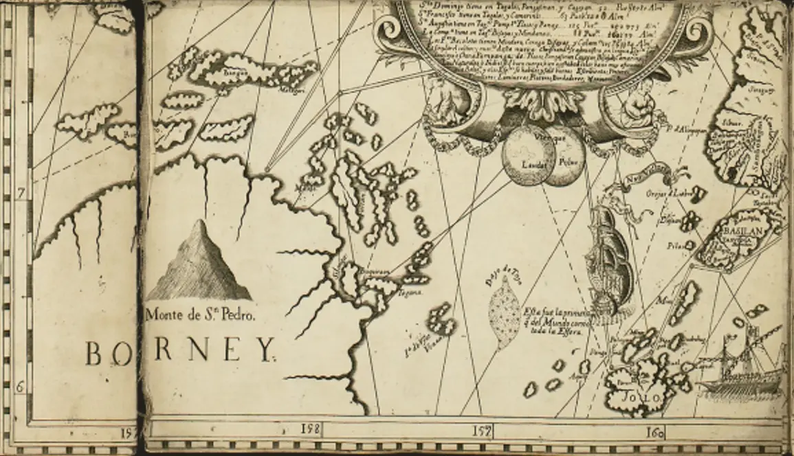
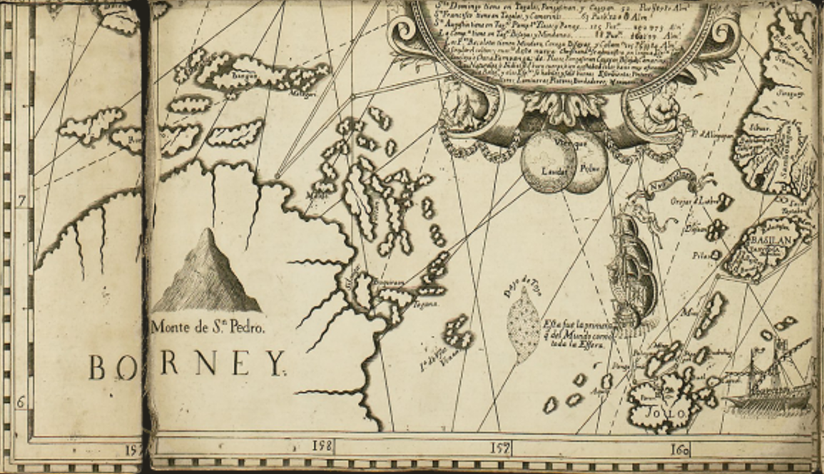
The quadrant B22 of the Murillo Velarde 1734 map focuses on Western Mindanao, including the Sulu Archipelago, Basilan, and parts of Borneo. This section highlights important geographical features, settlements, and maritime routes used during the Spanish colonial era.
-
Monte de S. Pedro (Mount of St. Peter)
-
This is prominently labeled in Borneo, likely referring to Mount Kinabalu or another significant peak.
-
It serves as a navigational landmark for Spanish explorers and traders.
-
Basilan Island
-
Labeled as "Basilan," the island appears near the upper right side of the quadrant.
-
Basilan was historically a strategic location due to its proximity to Zamboanga and the Sulu Archipelago.
-
It was a key area for trade, conflict, and Spanish military campaigns against the Moro resistance.
-
Jolo (Sulu Archipelago)
-
Jolo is prominently marked, indicating its significance as the center of the Sultanate of Sulu.
-
The Sultanate controlled much of the southern Philippines, Borneo, and the trade routes connecting the region to the wider Malay world.
-
The map shows Spanish galleons, suggesting naval battles or trade routes between Jolo and the Spanish-controlled territories.
-
Maritime Routes & Galleons
-
Several dashed lines represent maritime routes, possibly Spanish naval paths, trade routes, or missionary expeditions.
-
Two large Spanish ships are depicted, likely symbolizing the Manila-Acapulco galleons or Spanish expeditions to suppress Moro pirates.
-
Geographical Locations and Native Settlements
-
The map includes islands, settlements, and native landmarks that were crucial during the Spanish era.
-
It provides insight into how the Spanish perceived Mindanao, Borneo, and the Sulu region as interconnected through trade, conflict, and colonization efforts.
Historical Significance of the Region in the 18th Century
Sorry, no results matching your search criteria were found.
Locations
This is a primary location.