2 photos
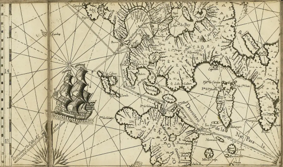
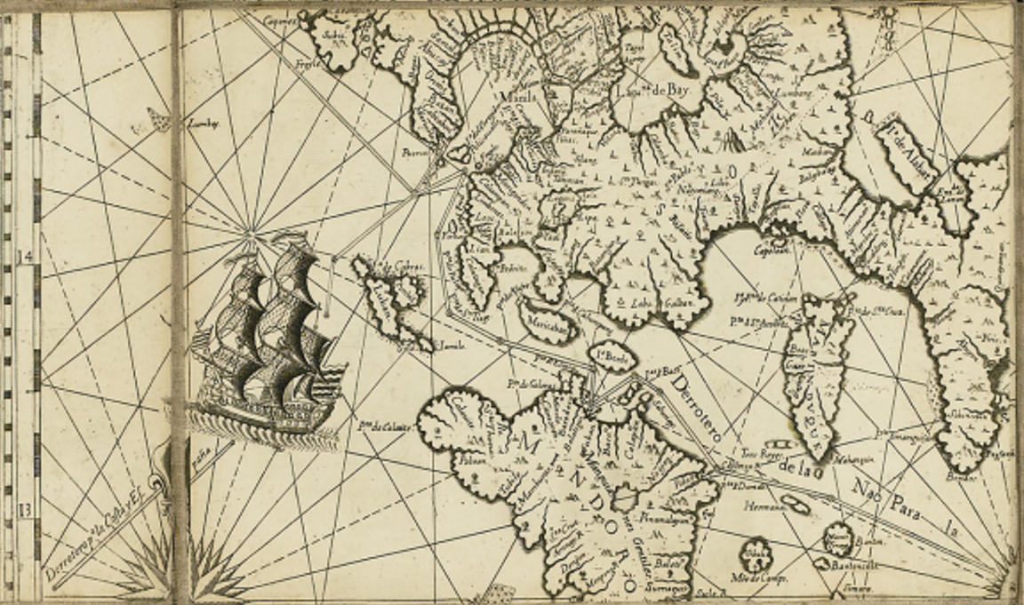
The quadrant prominently features Manila, Laguna de Bay, Batangas, and Mindoro, along with smaller islands such as Maricaban and Lubang.
Spanish cartographic style highlights rivers, mountains, and settlements, demonstrating detailed geographic knowledge.
Spanish annotations mark significant locations, including fortified towns, missions, and indigenous settlements.
A large Spanish galleon is illustrated, symbolizing the importance of the Manila-Acapulco Galleon Trade.
Derrotero (navigation routes) are drawn, guiding ships through key areas such as Verde Island Passage, Mindoro Strait, and Manila Bay.
The presence of compass roses and rhumb lines suggests the significance of navigational aids for sailors.
Manila’s port is shown as a crucial maritime hub connecting the Philippines to Mexico and the rest of Asia.
Manila is the focal point, depicted as the political, religious, and economic capital of the Spanish Philippines.
Laguna de Bay is illustrated as a key inland waterway, supporting agriculture, fishing, and local trade.
Spanish settlements and missions are marked, reflecting Christianization efforts in indigenous communities.
Batangas and Mindoro are shown as key locations for trade, shipbuilding, and defense.
Fortified coastal areas along Batangas and Mindoro suggest defense against pirate attacks and foreign incursions.
Mindoro is depicted as an essential source of shipbuilding materials and strategic military outpost.
Naval patrol routes are indicated, reinforcing Spanish efforts to secure maritime trade.
The map acknowledges indigenous settlements and trade centers, showing native participation in regional commerce.
Tagalog and Kapampangan regions are identified as thriving communities, supporting agriculture and local industries.
Interactions between the Spanish and native populations are evident, demonstrating colonial integration and resistance.
Highlights Manila’s central role in the Spanish colonial empire in Asia.
Showcases Spanish maritime dominance and navigation routes in the Philippines.
Provides insight into settlement patterns, trade centers, and indigenous communities.
Reflects the economic and military priorities of Spain in the 18th century.
