Quadrant D8 Ysla Degvajan

Quadrant D8 Ysla Degvajan

@quadrant-D8-ysla-degvajan

Associated Sub Page

Murillo Velarde 1734 Map

Recently Viewed Pages

  • 0 Likes 0 Comments 20.3K Views 0 Favourites
  • 2 Likes 0 Comments 13.4K Views 1 Favourite
  • 0 Likes 0 Comments 5.9K Views 0 Favourites

Overview

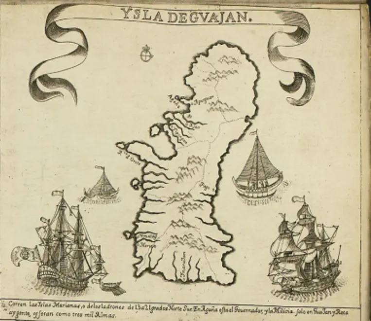
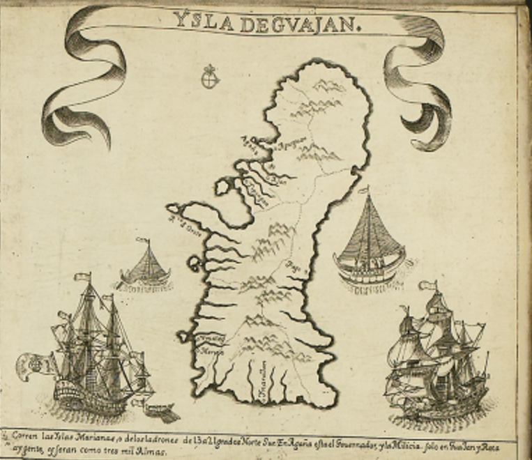
The Quadrant D8 of the Murillo Velarde 1734 map, which features "Ysla de Guajan" (Island of Guam).

1. Island Depiction

    • The map illustrates Guam, the largest island in the Mariana Islands.

    • It is shown with mountain ranges, rivers, and coastal settlements.

    • Spanish annotations label key locations.

  1. Maritime Elements

    • Galleons & Native Boats

      • The quadrant includes Spanish galleons and local Chamorro canoes, signifying the maritime activity in the region.

      • This highlights Guam’s role as a key stopover for the Manila-Acapulco Galleon Trade.

    • Compass Rose & Navigation Marks

      • Helps Spanish navigators chart courses through the Pacific.

  2. Historical Context

    • Spanish Colonization

      • Guam was a vital resupply point for Spanish ships crossing the Pacific.

      • The island was administered from Manila, reinforcing the Philippines' importance in Spain’s Pacific empire.

    • Chamorro Population

      • The text mentions a population estimate of around 3,000 people.

      • The native Chamorro people were influenced by Spanish missions and governance.

  3. Strategic Importance

    • Guam served as a Spanish military outpost against pirate raids and foreign incursions.

    • The island was a key link between the Philippines and New Spain (Mexico).

Significance of This Quadrant

  • Highlights Guam’s role in the Spanish Empire and its connection to the Philippines.

  • Illustrates early Chamorro culture and Spanish influences.

  • Provides insight into Spanish maritime routes in the Pacific.
