Overview
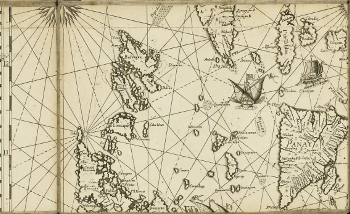
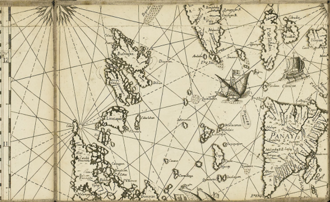
Quadrant B14 captures the heart of Spanish maritime trade and administration in the Philippines. It highlights colonial governance, trade routes, and native maritime interactions, making it a crucial section of the 1734 Murillo Velarde map.
Geographic Overview
This quadrant covers Southern Luzon, Western Visayas, and surrounding islands, highlighting settlements, trade routes, and maritime elements in the 18th-century Philippines.
Southern Luzon
-
Key coastal settlements such as Calapan (Mindoro) and Batangas are visible, showing early Spanish presence.
-
Cavite, a major Spanish naval base, lies just outside the quadrant but influences trade and defense in the region.
Western Visayas
-
Panay Island is prominently labeled, with settlements like Iloilo, Ogtong (Oton), and Mambusao, reflecting its role as a Spanish colonial hub.
-
Negros Island is partially depicted, showing early Spanish influence but less urban development than Panay.
Maritime Features
-
Nautical rhumb lines crisscross the waters, indicating Spanish navigation and trade routes.
-
Spanish galleon and native vessels reflect European-indigenous maritime interactions.
-
Small islands such as Marinduque and Romblon are labeled, marking key navigation points.
Cultural & Historical Context
Spanish Administration
-
Panay served as a key Spanish center, supplying food and manpower to colonial Manila.
-
The region was governed under the encomienda system, where Spanish officials controlled local labor and resources.
Maritime Trade & Defense
-
Spanish ships signify the galleon trade, linking the Philippines to Mexico and China.
-
Native boats suggest active local and inter-island commerce, showing indigenous maritime resilience.
Strategic Importance
-
Mindoro Strait (left of the quadrant) was a crucial passage for ships traveling between Manila and the Visayas.
-
Spanish fortifications and missions were built along these coasts to protect against pirate raids.
Significance of Quadrant B14
-
Spanish-controlled settlements in Luzon and the Visayas are well-mapped.
-
Trade hubs like Iloilo and Oton are highlighted, reinforcing Panay’s strategic role.
-
Major 18th-century trade routes are depicted, showing Spain’s maritime dominance.
-
Manila-Acapulco galleon trade is hinted at through Spanish ships and route markers.
-
Illustrations of indigenous and colonial maritime interactions reflect a blended trading economy.
-
Regional power centers are detailed, especially Panay’s role in supplying Manila.
-
Luzon, Mindoro, and Visayas islands show colonial expansion and economic dependencies.
Sorry, no results matching your search criteria were found.
Locations
This is a primary location.