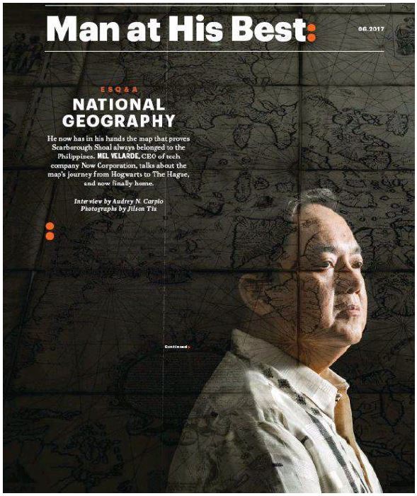
On the Cover
Man at His Best Esquire Q&A: National Geography
LINK:
https://www.pressreader.com/philippines/esquire-philippines/20170601/282071981859591
He now has in his hands the map that proves Scarborough Shoal always belonged to the Philippines.
MEL VELARDE, CEO of tech company Now Corporation, talks about the map’s journey from Hogwarts
to The Hague, and now finally home.
Esquire (Philippines) | 1 Jun 2017 | Interview by Audrey N. Carpio Photographs by Jilson Tiu
How the “mother of Philippine maps” found its way home.
How did a map of the Philippines end up in some dank English castle? In 1762, the British occupied Manila, following their victory over Spanish forces in the Battle of Manila. When Manila fell on October 6, 1762, British soldiers pillaged (and raped, razed, and plundered) the city for 40 hours. One of the
looted artifacts, taken by Brigadier General William Draper, was a set of eight copperplates of the 1734 Pedro Murillo Velarde map, the most comprehensive map of the archipelago at the time. (Fr. Murillo Velarde was the Jesuit priest and polymath who designed the map, also known as Carta hydrographic y chorographica de las Islas Filipinas, but it was drawn and engraved by the skilled Filipino artisans Francisco Suarez and Nicolas de la Cruz Bagay.)
Draper donated the copperplates to Cambridge University, which ran new prints of the map. Later, the British melted the copperplates when they needed copper to print their admiralty charts. One of these prints was then acquired by the Duke of Northumberland, who kept the map for over two
hundred years, until it was unearthed after the flood, put to the auction hammer and won over the phone by a Filipino IT entrepreneur named Mel Velarde (no apparent relation to Pedro) in 2014. The Supreme Court Justice Antonio Carpio had encouraged Velarde to acquire it for the good of the nation, after several museums he first approached said they couldn’t afford the pricey artifact.
The “Mother of all Philippine Maps” arrived in the country on April 28, nearly three years after it was auctioned off. Esquire emailed Mel Velarde to talk about the map, which he is donating to the National Museum.
ESQUIRE: What does it feel like to finally bring the Murillo Velarde map home?
MEL VELARDE: Jubilation and relief. The signing of the deed of donation with the Solicitor General Jose Calida last April 21, 2017, and the subsequent collection of the map from Sotheby’s London, handed to me personally and to the Assistant Solicitor General (Usec. Henry Angeles) last April 28,
2017, marked the culmination of a journey that started on November 4, 2014. On that day of the auction, I had a mission: to participate in the auction of this map by Sotheby’s London, to win the auction and bring that map back to the Philippines. I embrace this whole journey as a personal civic
duty; as this journey culminates, I have jubilation in my heart, and triumph in my mind. Relief, too, because the 1734 Murillo Velarde map has finally arrived in the Philippines, and will be formally turned over to the government on June 12, 2017.
ESQ: The map took almost three years to make its way here after it was won at auction. Can you tell us what has been happening since then, and why it had been decided to bring in the map at this time?
MV: While the case at UNCLOS was ongoing, keeping the map at Sotheby’s London would be convenient if in case—for whatever reason—it is needed. When UNCLOS released its decision in July last year, we began the process of its eventual transport to the Philippines including, among others, the signing of a deed of donation, the physical examination of the map by the National Museum team of experts, the securing of export license from the UK government, and the actual physical collection of the map by me and the official representative of the Philippine government.
ESQ: Did the map play any part in the arbitration hearings at The Hague?
MV: The 1734 Murillo Velarde map as historic artifact was cited in the Philippine complaint against China at UNCLOS. There are very few copies of this map in the world today—you can count them on one hand. Problem was the Filipino people, through their government, never owned a single copy of
this map. I was told it would be of enormous value that we as a people would own a copy of this map for current and future concerns.
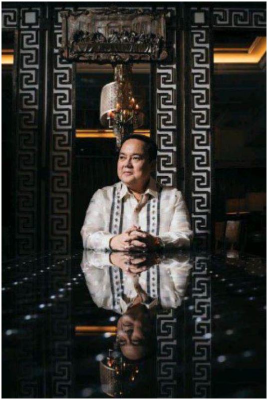
ESQ: You were engaged in a bidding war that brought up the price of the map up to P12 million. What went on in your mind? Who were the other bidders?
MV: The floor price was about P1.5 million. At most, we calculated that this could double or even reach four million pesos to conclude the auction. There were a number of bidders who just increased whatever price I gave; I just heard their voices over the telephone and I wondered what business they had with this map. So furious was the bidding that I felt I was buying a company with valuable and quantifiable assets. Later on I found out there was a Filipino conglomerate that participated, and some Asian individuals participated as well.
Because the map’s value could not be quantified at that moment, I realized it is precisely not quantifiable because its value is incalculable. After the four million peso ceiling was breached during the bidding, the dominant thing in my mind was to win; I felt there was a larger consideration in this whole exercise where my personal role was but a footnote. In my mind, I was reminded of soldiers ready to die for our country. It’s a long shot, and quite a stretch of imagination, to think that a map could prevent them from dying or getting into war, but I’d take that shot any day, nonetheless; so I did.
So many other things were in my mind: the map being the one true land title of every Filipino; it being historic artifact; an evidence of our historic rights; a source of narrative for our youth to love our country; an embodiment of our material being as a nation, so on and on, so many other things came into my mind until the price reached almost P13 million. Voila! I won the bidding for the mother of all Philippine maps. I knew right then and there, she was not mine to keep. My role was to return her to the people, to whom she rightfully belongs. In short, just to bring her back home.
ESQ: Aside from the fact that Panacot (Scarborough Shoal) is shown to be part of the Philippines, what else can we learn from this centuries-old map?
MV: Spratlys is shown there as Los Bajos de Paragua. The superb artistic creations through drawings of the twelve vignettes that depict a high quality, advanced and inclusive way of life of people in the archipelago: showing Filipino men and women working in the farm that represents self-reliance, family unity and sustainable livelihood; showing Armenian, Chinese, Japanese, Spanish, Moguls freely interacting with the indios; men and women from various economic classes, from top to bottom, engaging with each other in public sites, with freedom, mutual trust and peace; the modern urban planning and design shown in the cities Manila and Zamboanga, that identified the public sites, the church location, the fountains of fresh water flowing through the community, the house of the governor, etcetera, etceter— all showing elements of facilities and comforts similar to the best urbanized cities in Spain and other parts of Europe; A new route for the Spanish ships, suggested by Fr. Murillo Velarde, sailing northward from Palawan to the tip of Luzon and turning eastward to reach Mexico, an alternative route to the usual winding cruise through the Visayan seas where said ships were vulnerable to pirate attacks.
There are almost 900 cities and towns identified in the map, which Filipinos of today [can recognize], since most of the [towns’] names have remained the same, and their locations are surprisingly accurate, including the markers for mountains, seas, lakes, trees, etc.
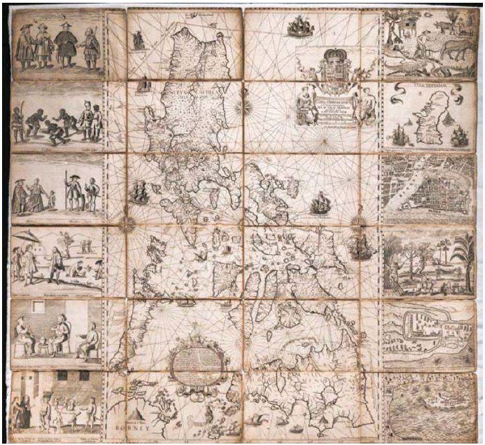
Between the islands of Palawan and Mindanao, a large medallion is drawn on the map and inside it is an enumeration of the major resources such as animals and plants, fruits and minerals, and all other nature’s bounties—each identified in particular—all intended to highlight the richness and diversity of the resources in the archipelago. I call this the wealth medallion that is on the map.
I can go on and on, and we will never finish!
ESQ: Despite having won the Hague ruling, the Philippines is no closer to taking back our islands. Perhaps we should send a copy of the map to the Chinese embassy?
MV: That’s one. But seriously, it took more than eighty years before China took those islands from us. As early as in the mid 1930s, Chinese naval teams started planting fake markers bearing dates as early as 1900. Post-World War II Chinese children were indoctrinated and brainwashed to believe that these islands belong to them; so much so that when these kids grew old and took control of their government they launched the offensive and occupied these lands. Because of years of indoctrination, they felt that they were doing these based on moral grounds.
So how do we fight a super power whose present leadership and its followers committed these belligerent acts based on moral grounds? Well, the answer is: only through moral grounds.
We too, therefore, must be willing to carefully craft our moves for the next eighty to one hundred years in order to get these islands back. We must engage with the new generation of Chinese youth in authentic ways and manners that would summon their self-respecting values, appealing to them not by subservience or capitulation, but by moral reason.
The present minds of this generation, yours and mine, cannot fully comprehend the full measure and power of the UNCLOS decision to future generations. Yet, together with [the book The South China Sea Dispute: Philippine Sovereign Rights and Jurisdiction in The West Philippine Sea] of Justice Carpio, that UNCLOS decision provides ammunition to the real and more defining battles of tomorrow: battles that can only be won on stronger and more authentic moral grounds.
ESQ: Is there significance to having an actual, physical map in an era of post-truth, fake news and Facebook manipulation?
MV: Enormous significance. In [this era], authenticity becomes the rarest of assets, the most powerful tool of social influence. We have in our hands a most authentic map that can debunk posttruths, fake news and any Facebook manipulation.